Hanalei Valley Lookout Kauai - Perfect Family Picture!
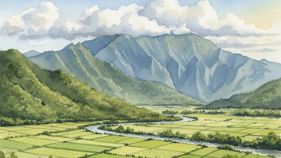
The Hanalei Valley Lookout is a designated pullout on Kuhio Highway (Route 560) at the Princeville boundary — approximately 30 miles north of Līhuʻe Airport. The view covers loʻi kalo taro fields on the valley floor below Namolokama Mountain, with waterfalls active after rain. The Hanalei National Wildlife Refuge sits in the valley, protecting endangered Hawaiian waterbirds including the Hawaiian stilt and coot; the refuge is closed to the public, making the lookout the primary vantage point. Early morning and late afternoon light favor photography. If this stop is part of a broader North Shore scouting trip, the [Moku advisor](/advisor) has active listings and STR data for the corridor.
Location and Logistics
The Hanalei Valley Lookout is a free, designated highway pullout on the mauka (mountain) side of Kuhio Highway (Route 560), just past Princeville Shopping Center — approximately 30 miles north of Līhuʻe Airport on Kauaʻi's North Shore. Stop time: 10–15 minutes. No entrance fee, no trail, no permit.
Parking is in a paved pullout adjacent to an active highway. Park fully within the designated area. Exiting back onto Route 560 requires patience — traffic flows in both directions toward Hanalei and back toward Princeville. Wait for a clear gap before pulling out.
What the Lookout Shows You
The valley floor holds loʻi kalo — taro fields cultivated here for centuries and still farmed today. Interpretive plaques at the pullout document the agricultural and cultural history of taro farming in the region.
The Hanalei National Wildlife Refuge occupies the valley and shelters endangered Hawaiian waterbirds, including the Hawaiian stilt and coot. The refuge is closed to the public; the lookout is the primary public vantage point over it.
Namolokama Mountain frames the far end of the valley. After rain — frequent on the North Shore year-round — waterfalls streak the ridgeline and add vertical contrast to the taro field panorama. The North Shore receives significantly more rainfall than Poʻipū on the South Shore, so waterfall conditions are favorable on most visits.
Nearby Worth Stopping For
- Hanalei Town — ~5 minutes west down Kuhio Highway. Boutique shops, galleries, food. Compact and walkable.
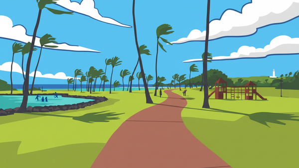
- Hanalei Bay — same 5-minute drive. Crescent beach, historic Hanalei Pier, surf in winter, calmer water May–September.
- Limahuli Garden and Preserve — ~15 minutes further west on Route 560. Native Hawaiian plant collection, guided tours, direct ecological context for what you viewed at the lookout.
- Waimea Canyon — the "Grand Canyon of the Pacific." A separate day-trip: approximately 1.5 hours south, then up the canyon road. Different part of the island entirely.
- Nā Pali Coast — boat tours depart from Hanalei Bay; hiking access starts at the end of Route 560 via the Kalalau Trail. Plan a full day.
Kauaʻi's backcountry and ocean conditions are serious. Stay on lifeguarded beaches for swimming and consult locals or a licensed guide before any backcountry hiking.
Timing and Conditions
- Early morning and late afternoon deliver the lowest sun angle and longest shadows on the valley floor — the best conditions for photography.
- Post-rain: waterfalls on Namolokama are active and visible. North Shore showers pass quickly; if clouds are low, give it 20 minutes before concluding the view is unavailable.
- Crowd window: midweek and early morning see fewer vehicles at the pullout.
- A polarizing filter — or the polarizer setting on most current smartphone cameras — reduces glare off the taro field water and deepens the green of the valley floor.
The North Shore Real Estate Context
The Hanalei Valley Lookout sits at the gateway to Kauaʻi's most active real estate corridor. Princeville, immediately east, holds the island's largest concentration of VDA-approved vacation rentals — priced from roughly $800K to $3M+. Hanalei Town below the valley is fee-simple residential with limited inventory and minimal turnover.
If you're combining a property scout with the drive, run the Moku advisor for a North Shore briefing: active listings, comp bands by complex, and STR revenue data by zone.
What to Verify Before You Go
- No restroom facilities at the pullout. Use facilities at Princeville Shopping Center before stopping.
- Highway shoulder is narrow. Keep children away from the road edge at all times.
- Ocean conditions at Hanalei Bay vary by season. Check surf reports and swim only at lifeguarded sections.
- The Hanalei National Wildlife Refuge is closed to the public — do not attempt to enter the valley from the lookout.
About Moku Intel
Moku Intel is a Kauai real estate intelligence platform — live MLS, vacation-rental revenue data, cost-segregation and 1031 modeling, and an AI research assistant. Built in partnership with Henry Beam, Real Estate Salesperson, Hawaiʻi, who handles showings, comp pulls, and transaction work when you're ready.
Keep reading


Thinking about Kauaʻi?
Six months out or ready this quarter — fifteen minutes with a licensed Kauaʻi specialist usually answers whether the island is the right call for your situation.