
Your Guide to the Beauty of Opaekaa Falls Kauai
ʻŌpaekaʻa Falls is Kauaʻi's most efficient cultural stop: 151 feet of freefall, paved lookout off Kuamoʻo Road (Hwy 580), free parking, restrooms on site, and Poliʻahu Heiau — a preserved ancient heiau — directly across the road. The Wailua River Valley surrounding the falls was a major political and religious center in pre-contact Hawaiʻi, considered among the most sacred landscapes on the island. This guide covers the falls' cultural context, what's in the corridor (Fern Grotto, Kamokila Hawaiian Village, Kuamoʻo Trail), and practical visit logistics. No hiking required to reach the viewpoint. No drones permitted. Best flow post-rainfall — wet-season visits (November–March) produce the heaviest water volume.
ʻŌpaekaʻa Falls is Kauaʻi's most efficient cultural stop: 151 feet of freefall visible from a paved lookout off Kuamoʻo Road, free parking, restrooms on site, and Poliʻahu Heiau — a preserved ancient temple — directly across the road. Total time investment: 20–30 minutes. The Wailua River Valley delivers two significant sites for the cost of one parking spot.
The Quick Brief
- Height: ~151 feet, cascading into a hidden pool below
- Name meaning: ʻōpaekaʻa = "rolling shrimp" — a reference to the shrimp once abundant in the stream
- Location: ~2 miles inland from Wailua, off Kuamoʻo Road (Highway 580), East Side Kauaʻi
- Facilities: Paved lookout, picnic tables, restrooms, interpretive signage
- Drones: Not permitted
- Best flow: Post-rainfall; wet season (November–March) peaks
Cultural Context: Wailua River Valley
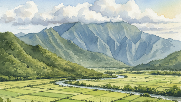
The Wailua River Valley is the most archaeologically significant corridor on Kauaʻi. In pre-contact Hawaiʻi, it served as a major political and religious center — so sacred that only aliʻi (chiefs) were permitted to live at the river's mouth. The valley's ridgelines supported active taro agriculture and communities that depended on the Wailua River for sustenance and transport. ʻŌpaekaʻa Falls sits within this cultural landscape, surrounded by native ferns, hibiscus, and ti plants that signal an active riparian ecosystem.
Directly across Kuamoʻo Road from the falls lookout stands Poliʻahu Heiau, one of the valley's best-preserved ancient temples, with sightlines to both the river and the ocean. One parking stop covers both sites. Budget an extra 10–15 minutes for the heiau.
What Else Is in the Corridor
The Wailua River feeds ʻŌpaekaʻa Falls and is the only navigable river in Hawaiʻi. Accessible from the water or roadside:
- Fern Grotto — a lava rock cave covered in native ferns; reached by kayak or guided boat tour departing from Wailua Marina (~2 miles from the falls lookout)
- Kamokila Hawaiian Village — a reconstructed traditional Hawaiian settlement on the river's edge
- Wailua Complex of Heiaus — multiple ancient temple sites distributed across the valley floor
- Kuamoʻo Trail — a moderate overland hike with Wailua River views and native plant exposure
For Buyers Considering the East Side
The Wailua–Kapaʻa corridor is Kauaʻi's most accessible residential entry point: condos from the high $400Ks, single-family from the mid $700Ks. Proximity to the Wailua River, ʻŌpaekaʻa Falls, and the broader Coconut Coast isn't incidental to value — it's a primary lifestyle driver for the East Side buyer archetype. Ask Moku about active East Side listings and the lifestyle-to-price read for this corridor.
Visit Logistics
- Lookout is paved and accessible — no trail required to reach the viewpoint
- Water flow peaks post-rainfall; Kauaʻi's East Side averages 40–60 inches of annual rainfall annually
- Wet-season visits (November–March) produce the heaviest volume; dry-season flow is reduced but the falls remain visible year-round
- No drones permitted at the site
- Picnic tables and restrooms available at the lookout
- Poliʻahu Heiau is directly across the road — same stop, two sites, no additional driving required
About Moku Intel
Moku Intel is a Kauai real estate intelligence platform — live MLS, vacation-rental revenue data, cost-segregation and 1031 modeling, and an AI research assistant. Built in partnership with Henry Beam, Real Estate Salesperson, Hawaiʻi, who handles showings, comp pulls, and transaction work when you're ready.
Keep reading
Thinking about Kauaʻi?
Six months out or ready this quarter — fifteen minutes with a licensed Kauaʻi specialist usually answers whether the island is the right call for your situation.